Friday, March 27, 2009
Great stuff! Ditch school buses
Since this is where we're going anyway, let's start now. Heck, we've already got free Cherriots passes started for some students; just extend that to all Salem-Keizer students!
Help avoid a Katrina in Salem
Remember, after Katrina, when everyone was asking "What sort of genius builds in an area obviously in danger of flooding?"
Well, with luck, not Salem. But we can't count on it.
===============
1347 Spyglass Court SE
Salem, OR 97306
503-588-6924
Friends of Marion County
P.O. Box 3274
Salem, OR 97302
Well, with luck, not Salem. But we can't count on it.
===============
You've been hearing a lot about flooding in Fargo, ND -- but it could be Salem in a few years if Battle Creek gets developed. That's why you (and please bring your friends) need to come to the Mayor and Council meeting on April 6 -- public hearing starts at 7:30 p.m.Lora Meisner
For more detailed information see "Battle Creek News" below.
Battle Creek News
Updates for the Battle Creek community
This newsletter is produced by The Comprehensive Plan Supporters (COPS), a nonprofit neighborhood association that has worked for the past two years on upholding the Comprehensive Plan and Battle Creek as open space. COPS and other supporters testified to the Planning Commission in November. As you probably know they unfortunately ruled in favor of the developer. However, we aren't going to give up the fight, we appealed the outcome to the Mayor and City Council.
PLEASE NOTE: the Mayor and City Council will hear the appeal to the requested change in the Comprehensive Plan on April 6--mark your calendars and plan to be there.
Didn't the City buy a section, the southern 38-acres of the property?
Not exactly, the City has an OPTION to buy the property. If you want to read the entire document go to: www.savebattlecreek.com then click on
Library and the first document listed is "Amended Purchase and Sale Agreement..." This document clearly states that
1) the agreement only covers a 2-year period;
2) the city is only making a down payment of $200,000;
3) the city can walk away from this agreement any time during the 2-year time frame, in other words the city can decline to purchase the property and return it to the developer; and
4) the city agrees to mitigate the storm water from the northern section of the property on to the southern parcel.
Residents can go on the south parcel of the Battle Creek property as the fence has been taken down and technically it's city property for at
least the next two years.
What has COPS been doing lately?
John Shepard & Lora Meisner had conversations with several large organizations/institutions who could be affected by potential flooding. They have spoken to several legislators to see what help the state may be able to give us on this issue. Additionally, they have made presentations to many neighborhood associations to get support as well as signatures on our petition. The meetings were to both inform and to try to elicit some support to get the city council to not vote on a Comp Plan change UNTIL they do a hydrology study so the city knows what it's dealing with. Several neighborhood associations (not SGNA) have been supported of our efforts.
Additionally, John (with Lora starting to help) is working with the Watershed Council to establish the Battle Creek Watershed Council. In forming this council it will assist us in keeping involved in the city's oversight of the south property as well as clean water and flood mitigation issues.
We also did outreach to the media and there is article published in the March issue of Salem Monthly on the Battle Creek issue. It is a good one and copies of the Salem Monthly can be obtained at the Library and other locations around Salem.
What Can We Do? How Can We Help?
We still need help with signatures on petitions as well as letters to the editor of the Statesman Journal. March will be a good month to bombard them with letters as the hearing on the Comp Plan Change before the Mayor and Council will be on April 6 -- MARK YOUR CALENDAR FOR APRIL 6 !
We need each of you to bring a friend or two and fill up the auditorium--we need a great showing. If you want to say a few words, there's plenty of information on the back of this page. We need donations to support our efforts. Send a donation to COPS, 4742 Liberty Road S. #357, Salem, OR 97302-5000. For questions or more information email: savebattlecreek@yahoo.com.
This proposed change goes against the City's Comprehensive Plan and is a bad precedent for the city to engage in.
* The City of Salem Area Comprehensive Plan states under Urban Growth Policies: To preserve farmland and open space and to preserve
and enhance the livability of the area.
* In the Neighborhood Plans adopted by the City Council: Liberty-Boone Neighborhood Plan, adopted 1983. Liberty-Boone Neighborhood Plan specifies Open Space Policies: "The preservation of the area around Battle Creek shall be encouraged until clearly needed for development. With development, Battle Creek shall be preserved as a natural drainage way.
* This is also the first time that the city is considering putting a development in the middle of a floodplain and through an undefined floodway. Prior city developments have been along the edge of floodplains but not in the middle of one.
* There should be NO Comp Plan change without a hydrology study to determine the impact on flooding and on the watershed.
What the City of Salem cannot say (until an engineering study is completed), how much storm-water or floodwater can be mitigated on to the south portion of the property. They have not yet performed the necessary engineering on the property. They do not know what is even possible to do with the property.
* This is important: The city has an OPTION to buy the south parcel of property. In two years, the city can just walk away and give the property back to the developer, it can try to secure financing on it's own or secure financing through the developer. This option to buy the property is just that a big "maybe."
* What has been said is that “we may be able to mitigate up to 75 acre-feet of water on the south property”. What is an acre feet of water? One acre of land with water, which is covered one foot deep. During the 1996 flood, more than 75 acres of the Battle Creek property was flooded, many places more than 4 feet deep.
* Do you know that the north part of the Battle Creek property is approximately 2 feet lower than the south portion? The city promised to mitigate the storm-water/flood water from the north portion of the property on the south portion...how will they accomplish this? There will be at least 80 to 120 acre-feet from the north portion alone. The south portion is only 38 acres, 17 of which are already under the Battle Creek Floodway.
* More than 12 years of development upstream (since the 1996 flood) of the Battle Creek property has occurred creating substantial increases in non-permeable surfaces. This means more water to the creeks. Much of the undeveloped property in the Creekside area has stripped hillsides creating a flood/erosion risk.
* The north portion has floodway along Waln Creek that has not been defined. What is the danger building in a floodway?
* Where will those Salem boys put all that water? Will it go outward into the surrounding properties or move faster downstream or both. If it moves outward, neighboring homes will be flood. If water is driven faster down Battle Creek, erosion and new higher flood stages will occur. Battle Creek is a significant contributor to Mill Creek water flow. Mill Creek floods downtown Salem. The 1996 flood was a result of a 'la nina' weather pattern. These weather patterns occur about every 8 to 10 years. The most recent one caused the recent I-5/Chehalis flooding. Battle Creek water will contribute to higher flood peaks and earlier flood surges.
The Comprehensive Plan change would:
* Reduce the open space, which is contrary to the Comprehensive Plan and Neighborhood Plan. Open space is important to balance the high-density development that has been permitted in South Salem over the past 25 years (approved because the Battle Creek open space property is here).
* Lower property values of the citizens who have invested in homes in the area. More development in our community is not necessary. Recent testimony given to the city council stated that the Board of Realtors estimates that the buildable lots comprise 4.7-year inventory.
* Increase traffic problems for the neighborhood potentially 3500 more cars daily trips.
* Decreases quality of life in the area. Developing the last significant park open space south of Keubler Road.
1347 Spyglass Court SE
Salem, OR 97306
503-588-6924
Friends of Marion County
P.O. Box 3274
Salem, OR 97302
Yo, yoots of Salem: getcher free Cherriots pass
Attention (Selected Salem) Students
Students at the following schools are eligible for a FREE Cherriots bus pass that will let you ride Cherriots anytime until June 30, 2009.
To sign up for a free pass, fill out the online form (.pdf warning) and turn it in at your school's office.
Participating Schools
Students at the following schools are eligible for a FREE Cherriots bus pass that will let you ride Cherriots anytime until June 30, 2009.
To sign up for a free pass, fill out the online form (.pdf warning) and turn it in at your school's office.
Participating Schools
- Parrish Middle School
- Downtown Learning Center
- McKay High School
- North Salem High School
- Roberts High School
- Early College High School
Next Tuesday: Opportunity to help protect critical farmland
Please attend an important hearing next Tuesday March 31st in Salem on House Bill 3099. The hearing has been called to receive public testimony on this bill which would increase protection for farmland.
Date: March 31, 2009
Time: 3:00 PM
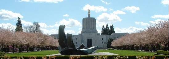
Location: State Capitol, Hearing Room E
Contact: Cheyenne Ross, Committee Administrator: 503-986-1734
Details: Please arrive early and sign up to testify.
The original purpose of the Exclusive Farm Use Zone is to protect Oregon's agricultural industry from conflicting uses and poorly planned development. Currently there are over 51 different non-farm uses allowed in the farm zone, ranging from private schools and private playgrounds, to gravel mines and golf courses. It is time stand up to protect our farmland!
Please join us next Tuesday to express your concerns directly to the legislators that will be making key decisions on farmland protection. Legislators need to hear your personal stories about why we need to pass HB 3099.
Please let the Land Use Committee know that you support HB 3099 because:
Farmland is not undeveloped land waiting for one of these conflicting uses. It is already developed land that supports one Oregon's leading industries. The agricultural industry is a primary driver of the Oregon economy and it keeps growing every year.
Most of these conflicting uses have nothing to do with farming. It's time to simplify our land use laws so that exclusive farm use zones are exclusively for farming.
Among other needed changes, HB 3099 would:
- Better protect our best soils from gravel mining, by requiring an analysis of alternatives
- Bar golf courses from high-value farmland
- Allow new schools on farmland only if they primarily serve the rural community, instead of kids bused in from nearby cities
The whole bill can be read at: http://www.leg.state.or.us/09reg/measures/hb3000.dir/hb3099.intro.html
- Help ensure that temporary medical hardship dwellings don't turn into permanent dwellings
Please let us know if you'll be able to join us to testify by contacting Tara Sulzen at 503-497-1000 or emailing her at tara@friends.org.
Thank you for all you do!
Subscribe to:
Posts (Atom)


